Total Pageviews

Saturday, June 18, 2011

Walking Jesus' Final Hours


Apologies in advance to those who have been faithfully reading this blog, but I am going to be much more abbreviated tonight than usual. We have to be up and away early tomorrow, so tonight is about packing and getting ready to go home.

Today, Saturday, was our last touring day. We started at the Church of St. Peter Gallicantu. “Gallicantu” means “the cock crowing.” This site is traditionally identified with the house of the high priest, Caiaphas. What a beautiful sanctuary! We sang “Open My Eyes, Lord” and soaked in the amazing art depicting the trials of Jesus and the denials by Peter. It was deeply moving to go down below into what may have been the pit or dungeon where Jesus was flogged and jailed overnight. The rocky hole was tight and hot, and it was easy to imagine Jesus being there on his night of suffering. We also saw what may have been the courtyard area where Peter denied Jesus by the fire. That was sobering, and all of us were caused to reflect upon our own spiritual failures.

Next, the Israel Museum and the Shrine of the Book. The first thing we did was spend some time at the 1:50 scale model of Jerusalem in 70 A.D. It is huge and incredible to behold. It took years and endless research to build. Just walking around the model with a capable tour guide like Anton Farah is very helpful for orienting yourself to a city—both ancient and modern— that can be very confusing to a first-time outsider.

Then we went inside to the Shrine of the Book. For those of us who are nerds about historical and textual matters, this is nirvana. The big draw here is the Dead Sea Scrolls exhibit—the Qumran artifacts, the scrolls themselves. Also, the Aleppo Codex is the lesser known display. Both exhibits are fascinating, and I could have spent hours here, but, alas, our time was growing short, and we had to move on.

After lunch at a local Middle Eastern spot, Alhambra, we moved over into the Old City and began the Via Dolorosa or Way of the Cross. Via Dolorosa means “way of suffering/passion.” This is the traditional path Jesus walked from arrest to trials to execution. Entering at Stephen’s Gate, by the eastern Muslim cemetery, we first went to the ruins of the Pool of Bethesda (John 5) and the Church of St. Anne. This is a Crusader church built on the site near the old sheep market where the Virgin Mary is thought (by traditional Catholics anyway) to have been born. Here, Kellie Miller sang a solo, then led us all in “Holy, Holy, Holy.” Kellie's voice is beautiful, and the acoustics here were outstanding!

Leaving St. Anne’s, we started through the fourteen Stations of the Cross. Beginning at Station One, the Church of Flagellation (where Jesus perhaps was flogged), we began walking the ancient streets that Jesus may well have walked that terrible Friday. Narrow, crowded with humanity thoroughfares—through houses and markets and street vendors and the busyness of life. This may have been what Jesus’ journey to the cross was like—streets crammed with real people with real issues living real lives. Most of the “stations” are simply a spot by the street designated “I… II… III… IV…” or whatever Roman number applies. There is the place where Jesus was given his cross. There are the spots where Jesus stumbled carrying the cross, the place where he met his mother, Simon of Cyrene, the girl Veronica who wiped his face, all the way up to being stripped of his clothes and nailed to the cross.

The stations lead to the Church of the Holy Sepulchre. Built in 325 by Constantine, this site has been the traditional location of both the crucifixion and the burial/resurrection since the 2nd century, during the reign of Hadrian. It was destroyed and rebuilt numerous times, and the Greek Orthodox and Roman Catholic churches have come to share this site that functions more as a shrine than as a church. It is hard to describe the parade of pilgrims who come to the Church of the Holy Sepulchre. Busload after busload of visitors from every place on earth come to pay homage, and it is something of a madhouse inside. The first thing you encounter is people—mainly Orthodox believers—kneeling and kissing a stone slab: This is the rock where the body of Jesus was, tradition says, cleaned and prepared for burial. Long lines wind there way through the dark, heavily ornate church, people waiting to see the tomb or go upstairs to see the spot identified as Golgotha. Directly under Golgotha, there is the Chapel of Adam, a small room featuring the rock broken by the crucifixion earthquake. After the Holy Sepulchre, many of us used our time in the market area of the Old City to do some shopping, grabbing last minute souvenirs and keepsakes from our trip.

Following this, we walked nearby to the Garden Tomb. This is an alternative possible site for both Golgotha and the tomb of Jesus. In many ways, it seems to be a more believable location ( it is certainly more peaceful). It’s outside the old wall, while the Holy Sepulchre is not. It seems to fit the general description of the locations in a variety of ways. A guide led us first to a rocky hill that looks down today over a bus station. The rocky face of the hill seems to resemble a skull (“Golgotha” means “place of the Skull,” you remember), with eyes and nose. The guide suggested if this was the site, then the actual execution more likely took place down in the area where the bus station is today, nearer the old highway and Damascus Gate. Scripture never says Jesus was crucified on a hill, by the way, but does say it was a place accessible to crowds. It was a moving experience to see the place where Jesus may have died.

Then, we ended up at the tomb. It’s a simple rock-cut tomb in the face of a cliff that has many of the marks of the Gospel accounts—a slot or trench for a rolling stone doorway, a low doorway, Joseph of Arimathea was a wealthy man with a “garden tomb” to donate, etc. After a brief introduction from the guide, we all went inside and looked at two small rooms. The entrance is into a left side grieving room, where the body would have been prepared. Then, on the right, there are two slabs—one front, one back—where the wrapped body could have been placed. Was this Jesus’ tomb? No one knows (though someone over the centuries left Christian cross markings inside and out to suggest they thought it was). But, even if it was not, it is certainly a tomb very much like the one Jesus was laid in. And, as the guide reminded us, the only thing that really matters about any possible tomb location is that all of them are empty. “Why do you look for the living among the dead? He is not here. He is risen.”

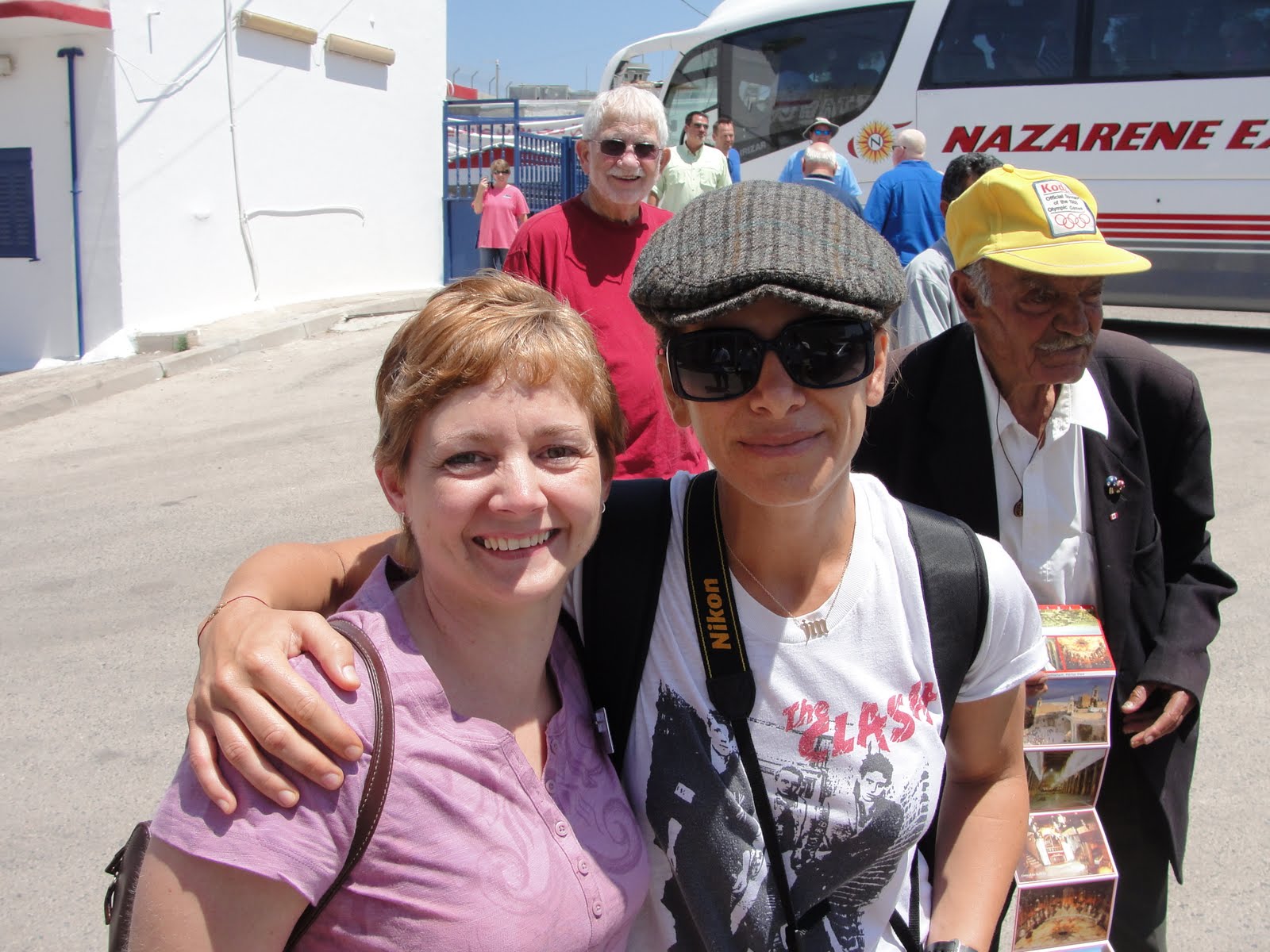
We had a farewell dinner tonight at a local restaurant. One more round of great Middle Eastern food was followed by some great sharing in the group. Gary McCaleb, our leader, did a fantastic job of summarizing our ten days together. We did a lot of bonding, and everyone—from teenager to senior citizen—brought something amazing to our little traveling community. There were a few tears and lots of hugs and promises to stay in touch, share photos online, etc.  Phil and Melinda and I gave Gary a little token of appreciation on behalf of everyone for putting the trip together, leading our group so well, and allowing the three of us co-leaders to tag along as helpers and enjoy the trip. We had a final prayer and called it an early night. Tomorrow is an early day. We will have breakfast and a quick communion service, then be on the road to the airport in Tel Aviv by 7:15 a.m. Our flight is at 11:3o or so, and we arrive back in DFW late on Sunday evening (9:30ish). Pray for our safe travel. Will try to post some final pictures when we can.

What a great adventure! Israel is a wonderful and special place, and we want to come back someday, but right now we are tired and very ready to come home and see our Jordan and Sarah! See you girls on Monday! Love, Mom and Dad.

שלום  Shalom,
Brent and Melinda


Friday, June 17, 2011

Photos (Day 8)

Praying at the Wailing Wall (women's side).

Our group at Huldah's Gate, standing on the original steps leading up to the Temple Mount from the south.

 Looking south from the City of David to Mt. Zion, the oldest part of Jerusalem.

In the traditional Last Supper upper room, singing with another group.

Fresh baked bread in the Jewish Quarter.


St. Mary of the Resurrection Abbey
Crusaders' Emmaus (Abu Ghosh) Church


Traditional site of Jesus' 
resurrection appearance (Luke 24)


"When he was at the table with them, he took bread, blessed and broke it, and gave it to them. Then their eyes were opened..." (Luke 24:30-31)

Out and About the Temple Mount

It’s our third evening in Jerusalem, and Sabbath just began. Sabbath impacts everything here, from what’s open and what neighborhoods you can drive through to what sort of breakfast you get on Saturday morning (only pre-boiled coffee and pre-cooked food). Friday, as Anton says, is not an easy day in Jerusalem. Tensions tend to run higher and angry people seem to be angrier. So, all of this drives what you choose to do on Friday before Sabbath preparation and Sabbath itself kicks in at 6:00pm. So, today we did some things in the Jewish Quarter that would have been inaccessible or difficult tomorrow.

We spent most of our day around the Temple Mount. As you approach the Temple Mount, the first thing that strikes you is the big high walls. These walls were built by the Ottoman Turks in the 1500s. We passed the Cave of King Zedekiah (see his sad story in 2 Ki. 25:1-7). We saw Herod’s Gate, one of seven open gates (one is closed, the Golden Gate). Driving down the eastern side, following the Kidron Valley opposite the Mt. of Olives, we turned back west and parked near the Dung Gate.

Anton reminded us that this area has been the place of high tensions for a number of years, the mosques here having been closed since 2000 (closed, at least, to non-believers). Most recently, there has been conflict about the Israelis changing a Muslim entrance to the southwestern Western Wall. Rocks have been thrown, mobs have had to be dispersed, and this is, after all, a Friday. There is always high drama (and dangerous drama) here over something. All this in mind, we left most of our gear on the bus and got out to make our group trek to the Wailing Wall.

The Wailing Wall is basically all that is left of the old Temple, a retaining wall built by—you guessed it—Herod the Great. Jews have two great wishes: To come to this place to pray, and to be buried on the Mt. of Olives. Even when they had no Ark of the Covenant after the Babylonians, the Jews still rebuilt their Temple. But with the Second Temple destroyed once and for all (70 A.D.), the only way to cling to the idea that the shekinah-glory of God was still present in this holy place was to attach his glory to the only remaining piece of it. So, the Wailing Wall reminds the faithful of the days when this was a place of greatness for the children of Abraham.

We all walked up to the Wall—men on our side, women on theirs (much smaller). Those of us who didn’t have hats or caps (required) borrowed a loaner from a box. Many of us touched the wall and prayed. I did. I said a prayer for everyone I know right now struggling with cancer or any other physical problem. No magic here, but it is a special place. The piety and devotion of the devout Orthodox Jews is something to behold. Many come here several times a week, some daily. A few practically never leave. They physically shake and read Torah and pray for Messiah to come back and rebuild the Temple. It is noisy and frenetic. Some of our guys got invited by a rabbi for a little side tour that ended with a request for a “donation.” I told them to give the guy a break. He’s a preacher and church costs money J

Our next stop was to walk nearby to the Jerusalem Archaeological Park (Davidson Center), located at the foot of the Southern Wall of the Temple Mount. This is active, on-going excavation. Just a few years ago, this area was a Muslim area (pre-1967) and covered in dirt. Highlights: Climbing up the original steps of the Huldah Gates that led to the Temple Mount. This was where commoners would have ascended or gone “up to the Temple.” This is where David brought the Ark into the city. Jesus would have engaged the Pharisees right here. Very cool... Also, seeing the Herodian Street, with its huge fallen stones, recalling the destruction of the city… The area of the money changers (where Jesus cleansed the Temple)… Ritual baths, Byzantine residences, the remains of the Muslim Ummayad Palaces, and a huge impressive tower built by the Fatimad Sultan and renovated by Crusaders and Muslims… All with the black dome of the Al-Aqsa Mosque looming over the high Southern Wall, where 100,000 to 200,000 Muslims visit every Friday. The big wall was built by the Turks, but the lower white stones go back to Herod the Great.

The Temple Mount is roughly 500 yards north to south. The Israeli Army protects the site (with plenty of visible guns), and the Muslim police guard it too (unarmed). The history, of course, is fascinating. This is where, traditionally, Abraham took Isaac to bind and sacrifice him (Gen. 22). Here at the threshing floor, David chose the spot for the Temple his son Solomon would eventually build. The First Temple was destroyed by the Babylonians in 586 B.C. (Very little has been discovered from the First Temple). The Second Temple was rebuilt in 515 B.C. with the leadership of Zerubbabel, on a much smaller scale than Solomon’s. Later, it became “Herod’s Temple” when the great builder of Israel expanded and renovated the complex. This was on-going in Jesus’ day. 70 A.D. saw this Temple burned and destroyed for the last time by the Roman armies of Titus, crushing the First Jewish Revolt. For many years, the Jews clung to the idea that the Temple would be rebuilt again, but the last straw was the failed Second Revolt of Bar-Kochba in the 120s A.D.

From that point forward, the Temple Mount spent centuries bare and undeveloped. Rome had pagan worship there, but when Christianity rose up with 313 B.C., the Temple Mount was cleared and remained that way throughout the Byzantine Era (4th-7th centuries). Christians never occupied or did anything with the Temple Mount. They believed its vacancy symbolized the Messianic promise of one stone not being left on another, so they let the weeds grow. When the Muslims came into Jerusalem in the 7th century, they found the Temple Mount being used as a garbage dump. This was the place where Islam said the prophet Mohammed came on his famous night dream ride. So, they cleaned the exposed bedrock (literally), put a golden dome over it, and the rest is history. The Dome of the Rock is a not a mosque but more like a shrine, a place to walk around and pay tribute. The Al-Aqsa (black domed) Mosque is a place of worship. “Al Aqsa” means “farthest place” and stands for the notion that this was the “farthest place” where the last prophet came in his night journey.

Going on south, we went “down” to the City of David. Jerusalem grew upward and northward over the centuries, from the old Jebusite city at the far south end of the Kidron (Mt. Zion), up the mountain to the city David established (City of David), and finally to the Temple Mount and beyond. Jerusalem’s great military weakness was always to the exposed north. At the City of David, we saw ruins that may well have been part of King David’s palace.

Then we went up into the Jewish Quarter, where we walked around for two hours or more. We went through narrow streets that go back to the time of the Crusaders (11th and 12th centuries), lined with monasteries and schools. Our first stop was the traditional Last Supper Room, which is a second floor room in a building built by the Crusaders (which means, even if it’s the right site, the building itself is too recent). But the room is still a powerful reminder of the type of place where Jesus shared his final Passover Seder with his disciples, giving the bread and wine a new interpretation. While we were there, another Christian group (Americans) sang (a cappella!), and it was a very nice experience.

Next we went to the traditional (again, Crusader) site for David’s Tomb. Not impressive. It was under construction, and there was very little to actually see. There is, however, in this district, an amazing and impressive statue of King David.

Then we walked over to the Burnt House. This site was discovered after 1968, when excavations unearthed a huge complex that probably belonged to someone important. Speculation has been that this was the home of the high priest (lots of ritual baths, signs of affluence, etc.). It’s called the “Burnt House” because it burned in the fire that destroyed Jerusalem in 70 A.D. A Roman spear was even found in the ruins. It is a pretty impressive display, complete with all manner of artifacts—lamps, measures, and even signs of pagan influence (little fertility amulets). We went to watch a video (more like a movie) about the Burnt House that illuminated the story well.

We had lunch at a Jewish kibbutz called Rabat Rachel, just outside the city. After eating, we went west to what was once the village of Emmaus (now Abu Ghosh, an Arab city). This is where, on the local mountaintop, King David went out to meet the Ark, being delivered by the sons of Abinadab. This was the first stop, then Uzzah’s little miscue, then on to the house of Obed-Edom (see 1 Sam. 6). There is a shrine here to that event. However, the event most of us associate with Emmaus is, of course, the resurrected Jesus revealing himself to two disciples here (Luke 24). We went to the Crusader church that promises to mark the spot where Jesus broke bread and made himself known to Cleopas and, well, Cleopas’ friend, whatever his name was. It’s a beautiful church. Downstairs we sat around a stone table and well that are perhaps the very spot where two heart-broken disciples got their hope restored.

After Emmaus, we drove back to the hotel and called it a day. Tomorrow promises to be big: The Way of the Cross (Via Dolorosa), the Church of the Holy Sepulchre, and the Garden Tomb are on the schedule. Our last day in Israel. We will give you a wrap-up tomorrow night.

For those of you in Texas, sorry to hear about the heat and drought. Makes us want to stay here, where it’s relatively cool and pleasant, particularly in the morning. Maybe 90 in the afternoons. Not bad at all. However, we are all pretty ready to see home and kids and family too! Grace and peace to all of you, from Jerusalem.

שבת-שלום  Shabbath Shalom
Brent and Melinda


Thursday, June 16, 2011

Photos (Day 7)

 The ruins of Herodium, Herod the Great's palace fortress in the Judean desert.
 
 The sanctuary and altar of the Church of the Nativity (Greek Orthodox) in Bethlehem.

The room under the Church of the Nativity where St. Jerome translated the Latin Vulgate Bible.

View of the old temple mount and the Dome of the Rock from the Mt. of Olives.

Olive trees in the Garden of Gethsemane.

Melinda with Jillian Michaels (from TV's "The Biggest Loser"), in Bethlehem.


Herodium, Bethlehem, and Gethsemane


Today was our first full day in Jerusalem, and it was most certainly full. After breakfast, we wound our way through the streets of East Jerusalem to Road One which pointed us south. This road was at one time (before 1967) the old demarcation line between the Jewish western city and the Arab east, with a small “no man’s land” buffer between.

We followed the road along the old Turkish wall built centuries ago by one of the sultans. We drove past elite markets, the King David Hotel, St. Andrew’s Church of Scotland, and day laborers waiting to be picked up, no matter how late the hour (see Matt. 21). We passed the Armenian section, and Anton recalled how, in the year 303 A.D., the Armenians were the first to accept Christianity as their national religion (ten years before Constantine’s Edict of Milan). The Armenians established themselves in Jerusalem very early, coming with the Crusaders as guides. The Turkish Armenians were later (early 20th century) massacred by Muslims for their cooperation with the enemy. Refugees scattered to various places, including Jerusalem. There are presently about 30,000 residents in the Armenian Quarter here. They are a proud people who work hard and have a reputation among Jews and Arabs as upright citizens and good neighbors.

Soon we were at our first military check-point of the day. We have negotiated several of these so far, both Israeli and Palestinian, and all have gone smoothly (no passport checks, etc.). Now we were in the West Bank, and city gave way to Bedouin herders and flocks. This is the Shepherds’ Field Road—the land of Naomi, Ruth, and Boaz. Here, shepherds still watch their flocks and keep food and animals in rocky caves that pock mark the area.

First stop, Herodium. Like a giant bubble, this mostly man-made mountain blows up out of the desert. Herodium was Herod the Great’s home, the place where he spent the majority of his time. His slaves built this incredible complex, and it is amazing to see it and think anyone could have done all this two thousand years ago. We parked the bus and hiked up to the top of the mountain, where you then look down into the hollowed out summit. This was old Herod’s world—bath house, a huge pool with an island, cisterns, even a synagogue. It’s not hard to imagine why Herod—who was despised by the Jews for being an Idumean and a Hellenist—wanted a retreat like this one, just far enough from Jerusalem to seal himself off from the stinking rabble there. Of course, this was just one among what may have been as many as eight palaces belonging to Herod.

From the summit, it’s striking how close Bethlehem and Jerusalem are, within eye and earshot. Did the crazy old king hear the screams of parents in Bethlehem the night his soldiers slaughtered their babies? Did he see the Magi riding in from the East long before they arrived? Everything being so compact here is one of the real revelations of a trip to the Holy Land. This is not Texas. Places are close together, by our standards. From Herodium, you can see the Mt. of Olives, downtown Bethlehem. You can see the village of Tekoa to the south, the prophet Amos’ hometown.

Herod died in Jericho, but ancient sources say he was buried at Herodium. After years of looking, his tomb was discovered about five years ago on the north side of the mountain, about halfway up. The archaeologist who had spent much of his life looking high and low finally found it before he died.

We exited the top of Herodium through an inner passage. An intricate set of narrow tunnels (a water system) that eventually served as a refuge for Jewish guerrilla rebels during the Second (Bar Kochba) Revolt in the 120s B.C. This was a very interesting site, and my only regret was we didn’t have more time, but we had other places to go.

Next we traveled back through the Shepherds’ Fields to the West Bank city of Bethlehem. First we went to the Kando family antiquities shop, where we shopped for a good while. The Kando family’s grandfather was the shoemaker who first got his hands on the Dead Sea Scrolls in the late 1940s. In fact, one of the jars that held some of these treasures is on display in the shop. They have coins, lamps, olive wood pieces, jewelry, and many beautiful things. We spent maybe an hour there, and I guess everyone left with something.

Oh, one curious side note… Melinda and some of the others in our group had a brief brush with celebrity. Leaving the store, they met TV personality and trainer Jillian Michaels (“The Biggest Loser”). Seemingly, she comes here with some frequency. At any rate, pictures were taken, and we moved on.  

Bethlehem, like most West Bank communities, is a teeming mass of humanity, most of who are struggling to get by. The population is about 30,000. As we navigate the crowded, littered streets, it’s hard not to think about Micah’s prophecy (5:2—“one of the little towns of Judah…”), not to mention carol “O Little Town of Bethlehem.”  Bethlehem means “house of bread,” and here—where Ruth gleaned grain—the Bread of Life would be born. The place Israel’s greatest king, David, would call home—here is where the Son of David would appear, announced first to nearby shepherds in the field with their sheep.  

When we arrived at the Church of the Nativity, we were besieged by street vendors—water, curios, postcards, you name it. We indulged one guy who took a group photo of all 36 of us, which many of us wound up purchasing, because it came out so well.

The Church of the Nativity was built by Constantine in the early 300s A.D., spearheaded by his mother Helena, who came to the Holy Land to identify holy sites. This site was marked as the birthplace of Jesus Christ. The location is shared by Catholic, Orthodox, Armenian, and Anglican groups.

We entered the Orthodox side, replete with icons, and waited our turn to enter the grotto under the main altar. Inside, we saw the traditional spot in a cave here Jesus was born (in Bethlehem, caves were used as barns or animal stables and still are). Just across the small room, we saw the rock (not wood) manger where Scripture says his mother laid him. We exited out the other side into the Roman Catholic side and went into the sanctuary that hosts Christmas Eve midnight mass every December 24th. One can only what this place is like with tens of thousands of holiday pilgrims filling the streets.

Next, we went to a late lunch at a local Bethlehem spot—“Ruth’s Restaurant.” The choice, as usual, was falafel (hummus in pita bread) or shawerma (chicken in pita). This has become our standard lunchtime menu. We could all use a burger or enchilada in a bad way, but we’ll get that soon enough. No complaining.

By now it was late afternoon. Our final stop was the Mt. of Olives and Gethsemane. Passing through another army checkpoint, back into Israel, we wound our way up north to the east side of Jerusalem, past the Valley of Hinnom. This was the old garbage dump where ancients burned their children as a sacrifice to Molech. It’s the place Jesus referred to as Gehenna, where fire and worms never die. Today, it’s just trees and grass and pleasant-looking homes and buildings.

We went to the top of the Mt. of Olives (also called Mt. Scopus) and spent some time just taking in the amazing view westward, across the Kidron Valley, into the city. Then we began a long, steep walk downward toward Jerusalem. This is about the path Jesus would have taken when he arrived on Palm Sunday. Coming from Bethany, to Bethphage, he would have topped the Mt. of Olives with followers singing hosannas in tow. Down we went, past the graves of the prophets Haggai and Zechariah. Down we went, Anton telling us about the large Jewish cemetery. He also told us about how, in the days of Jesus, Passover would have filled the Kidron Valley below with the blood of slaughtered lambs.

Soon we were at Gethsemane. It was smaller than I expected, really just a garden courtyard to the Church of All Nations. Gnarled, ancient olive trees make this spot look very much like it probably did when Jesus and his disciples came here so long ago. Gethsemane means “place of pressing,” referring to the olive vat and press that was once here. Here our Lord was pressed too. Here he agonized, struggling with his flesh on the night of his arrest and trials. Here he prayed, “Father, take this cup away. But your will be done.”

We went inside the gorgeous church (Catholic) and sat in on a few minutes of worship. A priest presided over the table, while nuns sang and read Scripture. It was beautiful. In front of the altar of the church is the focal point called the Rock of Agony, supposedly the very rock where Jesus knelt and prayed, while his sleepy disciples dozed a few yards away.

By now it was late evening and time to call it a day. We returned to the hotel and made plans to start earlier than usual tomorrow for another big day. Tomorrow may be the day we get to wade through Hezekiah’s Tunnel. We’ll let you know in 24 hours.

שָׁלוֹם עֲלֵיכֶם  Shalom Aleichem
Brent and Melinda


Wednesday, June 15, 2011

Photos (Day 6)

Wall and tower at Masada.

At Masada: Sydnie and Phil Schubert, Gary McCaleb, Brent and Melinda Isbell

En Gedi: "As the deer pants for water, so my soul thirsts for you, O Lord."

Cave 4 at Qumran: Cave of the Scrolls. 1,500 texts found here alone.

Looking down through the entrance into the traditional grave of Lazarus in Bethany.


Day in the Desert, and Up to Jerusalem

When the days drew near for him to be taken up, he set his face to go to Jerusalem. (Luke 9:51)

On Wednesday morning, we turned our collective gaze toward the northeast, to Jerusalem. And, at around 5:00 this evening, we did indeed check into the Grand Court Jerusalem Hotel. We are settling in for the night. I know everyone in our group looks forward to the next 3 days and 4 nights in this amazing ancient (and modern) city.

Okay, but that’s jumping ahead. We left our lodging at the Dead Sea bright and early this morning made our way back up the western shoreline to our first site: Masada. No one has to tell you what you’re looking at. When you get close enough to spot the great table mountain rising up east of the Dead Sea, you know immediately this is Masada, the stuff of lore and epic Hollywood movie-making.

Perhaps the most-repeated phrase of any Israel tour is “built by Herod the Great.” Herod was the Halliburton of his world, building huge projects all over his territory, and he built Masada too. There are ruins from the Hasmonean era, but it was Herod who developed the top of a remote mountain into a retreat palace complex for himself and a sight to behold for everyone else ever since, including the "flower children" of the youth movement who flocked here in the 1960s.

A cable car took us to the summit (a little higher than sea level), where our guide Anton began our walking tour around the 30+ acre site. The first part of the story is Herod. His palace was at the extreme north end of the mountain, perched on the side of the sheer cliff. It was an engineering marvel, complete with a sophisticated plumbing system, cisterns, and personal luxuries made just for the old paranoid king’s however-frequent visits. His bath house was five-star, featuring a changing room, cold-water room, warm-water room, and one for hot water and steam sauna treatments.

Herod died shortly after Jesus was born, and his sons apparently cared nothing for Masada (which means “fortress”), so it eventually became occupied by the Zealots who made it famous. When the Galilee, Jerusalem, and other Jewish communities fell to the Roman armies by 70 A.D., Zealot forces were chased east and fled to Masada to prepare for a last stand. It was a three-year siege with 960 men, women, and children atop the mountain. Rome sent 12,000 soldiers, and their camp sites can still be seen clearly below, along with the massive siege ramp they built up to the east wall. After three long years, in 73 A.D. the Romans finally breached the wall, only to discover that, by casting lots, the residents of Masada had committed mass suicide, choosing freedom over slavery or worse. We went into the room where those lots (names written on potsherds) were discovered. We also sat in the synagogue where scrolls were discovered that seem to be identical to ones at Qumran, just up the road (apparently the monks of Qumran at some point brought books to their neighbors).

It’s not hard to see why Masada is such a popular attraction and such a great point of pride for Jewish people, something like their Gettysburg or Alamo, I suppose. Until very recently, Israeli Army officers took the Oath of Masada in the large open space in the center of the compound. Today, young boy and girls have their bar mitzvahs and bat mitzvahs there, and now there is a large amphitheater below that hosts performers and events. Right now, the opera Aida is the featured attraction.

Next, we moved on to En Gedi. This is where David was chased by the jealous King Saul, and where he took refuge in the caves here. “En Gedi” means “spring of the wild goats (or deer).” The area is teeming with flora and fauna. There are acacia, tamarisk, and broom trees. We saw gazelles, ibexes, birds of prey, and hydrixes (a sort of badger). En Gedi is now a national park and reserve that offers some of Israel’s best natural beauty. The main attraction here is the waterfall, so the majority of our group followed Anton on a long hike up, up, up to its highest point. The walk is pretty tough—and it was a blistering hot day—but we all arrived to find a large crowd (many school kids) playing and taking photos around a lush oasis at the top and back of a deep canyon. The waterfall pours down out of dark caves into a pool below. The cool water and large trees make it clear why David and his mighty men came here and saw this as a place of refuge. The water brought to mind David’s psalm: “As the deer pants for water, so my soul thirsts for you, O God.” Above the falls is the cave where David lived and also the cave where, if you remember the story, he refused to take Saul’s life at a (ahem) very opportune moment. Nature calls kings too.

Our third stop was at Qumran. We ate lunch there first, then went with Anton on a short walking tour of the site. Qumran was an ancient Dead Sea community that produced and eventually hid the famous Dead Sea Scrolls. The small group of people who lived there—called the Essenes—lived on the rocky plain between the mountains and the eastern shore of the Sea of Salt (the beach being much closer to them back then). Ruins have revealed ritual baths (mikvahs), communal dining halls, living quarters, cisterns, rooms in which they copied texts, a cemetery and more. This was a community contemporary with Jesus, but any possible interaction between Jesus and the Essenes has never been established. Many have speculated that the eccentric prophet John the Baptist may have had some ties to Qumran, but again, no proof positive. These were apocalyptic people anticipating a big final war between good and evil. They took purity seriously and were convinced that the establishment religion of the Jerusalem temple was corrupt, its priests were sons of darkness.

But, crisis came knocking. When the Romans came to put down the Jewish Revolt in the 60’s A.D., the monks of Qumran seem to have chosen to hide their writings—Old Testament texts (all but Esther) and religious works of their own—in sealed jars in the almost-inaccessible caves in the mountains around where they lived. The scrolls were discovered in 1947 (it’s a long and fascinating story). Scrolls were discovered in eleven caves, many of which are clearly visible from the Dead Sea valley floor. We stood near Cave 4 (The Cave of the Scrolls). In this cavern alone, 1500 texts were discovered. And what a find the Dead Sea Scrolls turned out to be, providing us with texts older than anything we had previously by many centuries. After decades, all the Scrolls have now been translated.

From Qumran, we started up to Jerusalem. “Up to Jerusalem” is more than an expression—it’s a topographical reality. The road (by the way, the roads here are excellent) to Jerusalem is a long, steady, steep uphill grade. You climb through rocky passes in a stretch of Judean desert that is about as barren as it gets. This is the “Good Samaritan” road, and these days it is lined with Bedouin camps, shacks with tin roofs and lots of donkeys. Soon we crossed over into the West Bank and entered the ancient city of Bethany. The Arabs call it “Azariya” or “Lazarus.” This was the home of Lazarus and his sisters, Mary and Martha, Jesus’ friends. This was where Jesus stayed with some frequency and where he was anointed by a woman at a dinner party in the home of Simon the Leper. Bethany is a sad picture today—massive poverty, piles of garbage, few resources, problematic politics. The West Bank is a tough place to live for the mostly Arab Muslim population of 10,000 or so. Nearby, Bethphage is a little closer to Jerusalem—the place where Palm Sunday crowds met Jesus and shouted “Hosanna!” upon his arrival to the City of David.

Here in Bethany we visited the traditional tomb of Lazarus (see John 11). Up a narrow street, passing Palestinian vendors hawking their wares to Christian pilgrims, down into a stairway to a small, dark, musty room we went. There we saw a rock-cut tomb accessed by a low entrance into the ground. Inside were loculi, holes in the wall designed to host bodies of family members as they die. Perhaps this is the place where Lazarus was placed when he died (or a place like it).   

By now it was 4:00 or so. We left Bethany and the West Bank and headed up the east slope of the Mt. of Olives, through the upper Kidron Valley into, at long last, the city of Jerusalem. Our hotel is just north of the Old City. Much more to share in days to come about Jerusalem and what we find here.

Tomorrow: Bethlehem, Herodium, the Garden Tomb, the Israel Museum, Shrine of the Book and the Model Museum.   

שָׁלוֹם עֲלֵיכֶם  Shalom Aleichem
Brent and Melinda


Tuesday, June 14, 2011

Photos (Day 5)

The theater at Scythopolis. The featured attraction was often comedies mocking Christianity.

One of the colorful mosaics at Bet She'an.

Ruins at Jericho. "And the walls came tumbling down..."

Dr. Gary McCaleb and guide Anton Farah presenting Cynthia with her Cana Wedding Jar.

"Zacchaeus was a wee little man, and a wee little man was he. He climbed up in a sycamore tree..."

Our location tonight, the Daniel Dead Sea Hotel.

Roman Ruins and Salt Slime

It’s Tuesday evening in Israel. Today we said good-bye to beautiful, green Galilee and hello to the Judean desert. The contrasts are pretty strong! Galilee in the north is life and freshness. The Dead Sea to the south is death and harshness. Galilee both takes and gives its life-giving water. The Sea of Salt just takes, no exit, so it is dying slowly. But first things first…

We drove south out of Tiberias, watching Galilee fade away out our left windows. In 1969, Israel dammed up the Jordan just south of where it exits Galilee. The purpose was to preserve precious water in the north and not “waste” its run to the Dead Sea. That may or may not have been wise, but, whatever the case, the river quickly becomes little more than a trickle separating Israel and Jordan to the east. I couldn’t help recalling our seeing the raging headwaters we saw up north at Dan a couple of days ago. 

Our bus continued south through the land of Issachar. Anton said that Moshe Dayan grew up near here and pointed out river bridges perhaps five hundred yards away that were built by the Romans. Across the border to our east, Jordan’s Gilead Mountains were clearly visible. Hay fields, locust trees, mangoes, and bananas told us we were still in fertile country, but it was also pretty clear that we were changing terrain. More open country. Fewer and smaller trees. Locusts and carobs (you know, the stuff of John the Baptist’s diet) replace Galilee’s dense olives and oaks. Anton said in a couple of months the heat here will be unbearable for most of the day. It’s not unusual to top 120° in August. As we passed the remains of a twelfth-century British Crusader castle, I wondered if those English soldiers did any of that particular construction project during summertime.

First stop, Bet She’an, also known as Roman Scythopolis. I’ll just cut right to the summary—this was one of the most impressive things I’ve ever seen. Some on the trip who have been to Ephesus said it is very similar, if not in some ways better. Bet She’an showcases archaeology at its best. Major excavation and restoration have brought to life a significant Roman city that was a hub of entertainment for ancient citizens and visitors. A long main street (cardo) is lined with giant pillars. A well-preserved theater seated thousands. There is a hippodrome, beautiful mosaics, bath houses, and the ruins of a temple to Dionysius, the god of wine. This was a wild, wild place in its day, and even the rise of Christianity in the 300s didn’t tame the culture much. Only the incursion of Islam in the 7th-century finally brought an end to the hedonism of Scythopolis.

Many of us hiked up to the summit of the mountain or tell that rises above the ruins. This is where biblical Bet She’an was located, and it’s where Scripture says, after dying in battle with the Philistines, the bodies of Saul and Jonathan were brought to this place. A lone tree serves as a marker of the end of the dynasty of Israel’s first king. There are ruins at Bet She’an marking the presence of Canaanites, Egyptians, Romans, Byzantines, Crusaders, and Muslims over the past 3,500 years. Leaving this great site, we saw the peak of Mt. Gilboa to the west, the place where Saul and Jonathan died.

Late morning, we drove past old Jabesh-Gilead, once taken by Joshua and the Israelites on their way into Canaan. Soon after, we ourselves crossed over into the West Bank. Here, Palestinians and Jewish “settlements” (300,000 Jewish pop.) share space and an uneasy peace. You’d never know it from the fields of sunflowers and garlic, though you do occasionally spot a “Danger: Land Mines” sign. The West Bank is about 3,000 square miles of pretty rugged country—spare natural vegetation, dry and chalky soil (think driving between Sweetwater and Big Spring). This rough place is where Elisha the prophet called home. In this very area the old preacher killed forty-two children who made fun of his being bald. To the east are the mountains of Samaria, and in that direction we saw goats, sheep, and the ancient hillside caves where Bedouin shepherds store food and shelter animals.

We arrived in Jericho on a new road built with American aid money. The Palestinian refugee camps (from 1948) are basically shanty-towns and not easy to look at. There is widespread poverty and, as everyone knows, complicated politics, which seem endemic to this part of the world. We went through several check-points, both Israeli and Palestinian, before we drove into Jericho around 11:30. To the west, rising above Jericho, is the Mount of Temptation. Here Jesus, some say, was tempted by Satan after his baptism. One cave on the mountain is “Elijah’s Cave,” the spot where the prophet was cared for by God at a time when he really needed some caring for.

Jericho is the oldest city in the world, dating back to 8,000 B.C. In Jesus’ day, it was known for its palms. We toured the excavation site of the old city and saw the walls that were probably in place when Joshua’s army arrived there c.1200 B.C. And we all know what happened. Joshua fought the battle of Jericho, and the walls came tumbling down. And there is, apparently, some evidence that something (earthquake?) brought down or damaged some of the Canaanite wall at about that time frame.

After lunch at a local Palestinian restaurant, we had a special group moment. Cynthia Michaud, one of our tour group members, is getting married in September. We gathered and listened as our leader Gary McCaleb presented Cynthia with a handmade “wedding jar” from Cana, complete with flowers. It is also a wine container, and, even though the maker has deceased and his business is no longer in operation, Gary worked with guide Anton Farah to track one down. Cynthia was very moved, and we prayed a special prayer of blessing over her upcoming marriage to fiancée Cale. It was a nice moment. By the way, one of our other group couples—C.G. and Barbara Gray—will be celebrating 60 years of marriage later this month!

On the way out of Jericho, we saw the great-granddaughter (or something close) of Zacchaeus’ famous sycamore tree. Jericho is, of course, where he lived. It’s also where Blind Bartimaeus begged and near where a certain traveler in a story Jesus told was traveling when he was mugged by thieves and left for dead. Today, Jericho is a bustling city of 8,000 with busy streets and markets (and even a newly built casino).  

After Jericho, the terrain turns quickly to extreme desert. Within minutes, the north end of the Dead Sea is visible. Known as the Dead Sea, Sea of Salt, Eastern Sea, or Sea of Lot, the land around this body of water is arid and blistered in appearance. There is an almost eerie surface-of-the-moon feel as you move southward along the eastern bank. It sits on the Afro-Asia fault, the lowest place on earth. 1500 feet deep at its deepest, it's a dying body of water. No Jordan River feeding it anymore. Drying up and receding, the far southern end is now just a reservoir pumped in by Israel to make more salt. The dying Dead Sea is causing sinkholes and other issues. Some think it needs to be filled again. Across on the other side are the mountains of Moab. Nebo, where Moses died. The place where Ruth was from. The area where Balaam got owned by his donkey. 

They get less than 3 inches of rain a year down here. Scrub brush and date palms are about all you see. Wild ibexes, snakes, birds of prey. And rocks. Lots of rocks! Think Big Bend National Park—red, craggy mountains and canyons and caves and a chalky soil that reminds you of what we might call caliche back home. We passed Qumran and En Gedi and Masada, three of the places we will visit tomorrow.

By 4:00, we arrived at the Daniel Dead Sea Hotel at the far southern end of the Dead Sea. It’s surprisingly developed here, a little like a miniature Las Vegas rising up out of the desert—hotels, shops, spas, even a McDonald’s. We checked in, and most of us got in our swim gear and made our way to the beach to swim. Check that, I mean float. That’s about all you do. It’s 29% salt and minerals, and you can barely keep you feet on the hard salty sea floor. You bob like a cork. It’s a strange experience everyone should try. You don’t want to get water in your eyes, that’s for sure, and you should be prepared to stay in briefly and shower quickly and thoroughly when you’re out. You leave the water with a slimy salt film all over your body, and it stings if you don’t get it washed off soon.

From our vantage, you can see Mt. Sodom, where it is believed that Sodom and Gomorrah once thrived. Being down here in the badlands didn’t work out well at all for Lot and his clan, but it’s a great and interesting place to visit now. Just in case, though, we will make a point not to turn or look back when we leave tomorrow :-)

שָׁלוֹם עֲלֵיכֶם  Shalom Aleichem
Brent and Melinda


Monday, June 13, 2011

Photos (Day 4)

Church of the Annunciation (Orthodox) in Nazareth. Mary's Well (or Spring) is here.

Baptistery at Tagbha, site of the Miracle of Loaves and Fishes.

Watching Hannah the Weaver spindling cloth. Part of our Nazareth Village experience.

 From the top of Tabor, the Mount of Transfiguration.

A rainbow meets the south end of the Sea of Galilee, out our hotel window this evening.


Tabgha, Cana, Nazareth, and Mt. Tabor


Monday took us a little south and west to focus on locations that were surely formative and important in the life of Jesus, particularly in his childhood years. Taking the road up the western shore of Galilee, we went through Magdala, home of Mary Magdalene, and Ginnosaur (or Gennesaret), where five valleys meet and reach the lake together and where the best fruit in Israel is grown. Banana trees thrive here.

Soon we were at Tagbha, by the lake. This is the traditional site of Jesus’ miracle of the loaves and fishes, the feeding of the five thousand. There is a Benedictine monastery here that dates to the 5th century A.D. The baptisteries (by immersion) are interesting, and the church sanctuary features an altar with a large stone in the floor. The stone marks the site where some believe the miracle of transforming a little boy’s sack lunch actually happened. Kellie Miller, one of our group, is very gifted vocally, and while we were here she sang a solo of “The Lord’s Prayer” that was moving and beautiful.

Turning west, we went through thick groves of olive trees and rocky hills. These were the roads and passes that Jesus walked again and again. This was his home countryside, places that would have been familiar to him and his disciples. We saw rain to the north and got a little drizzle on the windshield as we passed through the ancient land of the tribe of Asher. Today it looks much like it did then—olive trees, goats, sheep, shepherds, fields of vegetables and melons.

Soon we came to Cana of Galilee. Here Jesus went to a wedding and turned water to wine, saving the host and happy couple a ton of embarrassment. Today the Church of the Wedding welcomes visitors and many who want to get married or renew vows. In Jesus’ day, it was a city of political zealots, like Simon, one of his disciples. Nathanael came from here too. The scene in John 2 focuses on the “reception” or after-party, but the wedding itself was undoubtedly in the synagogue here.

Just outside Cana is a town that used to be called Gath-Hepher. Only one Jewish prophet came from Galilee, and he came from this little town. His name was Jonah, son of Amittai.

Next stop, Nazareth. These days, Nazareth is a crowded, bustling place with about 140,000 population (60% Arabs, 30% Jews, 10% Christians). But in Jesus’ time, Nazareth probably was home to no more than 400 people. The topography here is striking—Nazareth sits on steep, hilly terrain. The farmers had no flat surfaces to work with, so they terraced everything, using brilliant ways of keeping the soil irrigated and in place.

Nazareth is where our guide, Anton, lives. And Nazareth is, of course, where we think Jesus did most of his growing up. Our first stop was the Church of the Annunciation. I should say one of them. More than one church vies for marking the spot where Mary got her angel visit and announcement that she would give birth to the Son of God. We went to the Greek Orthodox site, also known as “Gabriel’s Church,” since Gabriel was Mary’s angelic visitor. Here we saw Mary’s Well, where she might have drawn water. We toured the small sanctuary, which dates back to the Byzantine Era (4th century A.D.). We all chuckled to hear that this church’s last or “newest” addition came in the 1600s.

After the Church of the Annunciation, we went to the Nazareth Village exhibit, which is associated with, of all things, the local YMCA. For about fifteen years, they have been hosting visitors to Nazareth with a very well done experiential exhibit. A guide (in our case, a young local woman named Summer), walks the group through a brief history of Nazareth using actors and artisans who talk about threshing grain, pressing grapes and olives, weaving, etc. A carpenter (or tekton, as Scripture calls Jesus and Joseph) talked about his shop and what he did. In all likelihood, Jesus’ “trade” was broader than woodworker, something more like a general builder/furniture maker, someone who worked with wood, stone, metal, and other media to build and repair all kinds of things. We went into realistic rooms of ancient homes, shops, even finishing up in a synagogue.

We all know the story of Jesus returning to his hometown synagogue in Nazareth and standing to read from Isaiah, applying the passage to himself. But no prophet is loved in the place where he played as a kid. So they tried to kill him. Outside of Nazareth is a site called Mt. Precipice. We saw this place where the crowd probably attempted, unsuccessfully, to throw Jesus over the cliff. Now there is a Greek church atop that craggy hill.

We had a quick lunch in Cana at Amara Brothers Falaffel and Shawerma restaurant. The chicken was good, and Anton and our bus driver treated us afterward to some delicious baklava.

In the afternoon, we went to Mt. Tabor (or Tavor). We drove through the village of Kefer Tabor, then an affluent Muslim Bedouin (formerly nomadic) community at the base of the mountain. Here we transferred into vans and wound our way up the steep mountain, following a winding road with numerous sharp switchbacks. Finally we arrived at the summit of the traditional site associated with the story of Jesus’ transfiguration. “After six days…” Scripture says Jesus took three of his disciples up the mountain. Six days, then transfigured on the seventh (perfect) day! It was the perfect time, Jesus thought, to reveal his glory to Peter, James, and John. As usual, they weren’t prepared or even close to understanding. Peter’s idea of building three booths for Jesus, Moses, and Elijah is captured in the architecture of the church atop Tabor that features three raised tabernacles in memory of Peter’s misguided suggestion. Anton told the story of the Transfiguration and summed up Peter this way: “Simon Peter—long tongue, nothing in his head, much in his heart!” This is a Franciscan monastery (five monks), and it is a truly gorgeous building. But the best part is the view from Tabor. You can see a good part of Israel. We looked down into the valley where Deborah and Barak won their battle. We saw Megiddo. We saw the little city of En Dor, where Saul found a witch and where, by Anton’s suggestion, Jesus and his three disciples may have descended the mountain to find the rest of the group wrestling with how to handle a young boy with a demon. Remember? Lord, we can’t budge this thing. Yes, these only come out by prayer. And Jesus cast out the demonic force that was trying to kill the child. Maybe, Anton said, En Dor was just the kin of witchy, satanic place where things like that might happen.

We got back to Tiberias a little earlier than usual this afternoon. Tonight we pack up again, moving south tomorrow: Jordan River, Bet Shean (Scythopolis), Jericho, Mt. of Temptation, and finally to our next stay at the Daniel Dead Sea Hotel. We will go for a swim in the Dead Sea tomorrow night.

Everyone is doing well. It’s a great group. We now have our sea legs, and we are all getting to know each other better and better.

What a blessing to get to do this. We are filled and grateful.

שָׁלוֹם עֲלֵיכֶם  Shalom Aleichem
Brent and Melinda


Sunday, June 12, 2011

Photos (Day 3)

On the boat to Upper Galilee (ACU president Dr. Phil Schubert and daughter Sydnie)

 Preaching at the Mount of Beatitudes. Sunday communion service, July 12.

Guide Anton Farah lecturing inside the synagogue at Capernaum.

The ritual bath (mikvah) at Korazim. Something like a Jewish predecessor to later Christian baptisteries.

Pan's grotto at Caesarea Philippi in the Golan. Jesus: "And the gates of hell shall not prevail against it..." 

Tel Dan. City wall of ancient city of Laish, later occupied by Dan.


Upper Galilee

I apologize for this blog probably reading like a bad version of Cliff’s Notes on the Middle East, but what’s going on here is a little like trying to get a drink out of a fire hose, so please excuse the attempt to summarize way more than anybody can possibly absorb.

Sunday morning began with a boat ride north on Galilee. We put out here at Tiberias and spent about an hour slowly traveling up the western shore. The Sea of Galilee is, of course, a major centerpiece in Jesus’ ministry. His famous boat trips back and forth say much about his intentions to bring people together and break down walls of race and culture and more. The western shore was predominantly Jewish (mixed with Gentiles), while the eastern Decapolis region was largely pagan. Yet, Jesus loved both sides of the lake, taught on both sides, and did miracles on both sides. The boat (particularly in Mark’s Gospel) is a vehicle for communicating his universal mission. Galilee is about 8 miles at its widest (east-west) and approximately 14 miles long (north-south). Depth is up to 15o feet. A scary, terrifying place to be in a storm. It's a rift in he earth, surrounded by steep hills,  This is where, geologically, Asia and Africa meet, so there is still seismic activity, most light. Major quakes, like one in the 700s A.D., destroyed numerous cities, some never coming back. The last major earthquake here was in the 1920s.

We put ashore at the location of the “Jesus Boat” museum. A number of years ago, a drought revealed a first-century A.D. fishing boat in the reeds nearby. It was excavated and preserved and came to be known as the “Jesus Boat,” perhaps one very much like the ones Jesus was in with his disciples so many times. Now it’s on permanent display. From the museum, we went to the Mt. of Beatitudes, the traditional site where Jesus delivered the Sermon on the Mount. Is it? Who knows? But it made a great spot to have Sunday church. We gathered under a beautiful garden pavilion to pray, sing, and share the Supper. Oh, and I preached a little (yes, from Matthew 5-7).

Next stop, just a little north up the eastern shore to the fishing village of Capernaum (or Kefar Nahum). The sign welcomes you to “The Town of Jesus,” which is about right. Many of Jesus’ disciples came from Capernaum, and he spent considerable time here. It’s a well-excavated site, featuring a house identified with Peter (or at least Peter’s mother-in-law). This is where, perhaps, Jesus healed her of her fever, healed a paralytic lowered through the roof, and others. Anton Farah described it as Jesus’ “free clinic” to the Galilean masses. The synagogue there (where Jesus cast the demon from a man) is pretty cool. The old original dark-stoned building is visible at the base of the 4th-century white-stone one that rises above the surface today. It’s easy to imagine ancient assemblies of people gathered to discuss and pray and read Torah. By the way, the local rock here is almost black, volcanic, so it’s easy to spot the older, original building materials.

We ate lunch nearby right on the lake at a local fish restaurant. I had the “St. Peter’s Fish,” which is tilapia. Very good, though mine did not, unfortunately, prove to have a coin in its mouth, like Peter’s. There used to be more species of fish in Galilee than there are today (25 or so), but tilapia has always been the staple.

We went on to the ancient ruins of Chorazin (or Korazin). There is a ritual bath (mikvah) there. Like Capernaum, Chorazin too had a synagogue. Houston folks, I’m pretty sure that somewhere there exists a photo of Cynthia Michaud seated in the Moses Chair (reserved originally for wise, older males). My comment? “The Bering folks will think that’s just about right.” Along with Bethsaida, Chorazin is one of the cities on which Jesus pronounced woes.

Our journey into Upper Galilee sent us farter north, passing kibbutzes galore, avocados, pecan trees, cotton fields, and all kinds of lush, verdant scenery. This is the land of Naphtali, and our guide, Anton Farah, was born up here in this area, at Sieff. Soon we were near the Lebanon and Syria borders. In the city of Qiryat Shamona, we began seeing a lot more Israeli soldiers carrying automatic weapons. Things are a little tense up here with the rising unrest in Syria.

With Mt. Hermon now rising in the distance, towering above the landscape at more than 8,000 ft., we began going upward. No snow on Hermon right now (though it does have ski resorts), but its ice caves are still mostly frozen, melting and sending water southward down the Jordan to Galilee. This is the ancient cycle of this land. The cold, snowy Golan Heights water the dry south, season after season.

Anton explained that Hezbollah (in Lebanon) periodically fires its rockets into Qiryat Shamona and these northern villages. We looked across into Lebanon, where we could see an old bunker that was given years ago to Yassir Arafat, when he was still in power. We began spotting signs that indicated “Danger: Lands Mines.” At both our next two stops we could hear distant gunfire, either from Lebanon or Syria. Our guide simply said, “It happens here.”

We crossed into Syria to visit Caesarea Philippi (also known as Banias). Built by Philip, son of Herod the Great, this city was dedicated to Caesar Augustus, who had a temple here. The chief god was Pan, who was worshiped with loud music, drunkenness, and sexual acts with cult prostitutes. The excavations here on the mountainside (much by Church of Christ scholars like John Wilson) have uncovered amazing finds, and the cave of Pan and the shrine of the Nymphs on the cliff side are stunning. The place is both beautiful with its trees and rushing water (melting snow) and ugly with its story of pagan sin. This is where Jesus took his disciples and asked them, “Who do they say I am?” (Matthew 16). Peter famously confessed, “You are the Christ, the Son of God.” Then Jesus affirmed Peter’s confession and said—perhaps with Pan’s goat-sacrifice grotto looming in the background—“And the gates of hades will not prevail against it.” With the craggy face of the mountain behind him, he told Peter that “upon this rock I will build my church.” The symbolism and contrast must have been powerful.

Our last stop was equally memorable—Tel Dan. This is the northernmost site in Israel. Remember the Old Testament refrain “from Dan to Beersheba”? At Dan, you get a gorgeous nature walk through essentially a forest (or jungle) of thick trees and flowering plants. We saw hundreds of school children in groups here. We crossed the rapid headwaters of the Jordan (which means “coming from Dan”), then Anton gave us a detailed walk through the excavated ruins of the old city of Dan, which was once something remarkable. This is where the tribe of Dan relocated after initial settlement in the west. Their great wall still partially stands (with a few Hezbollah bullet holes). We saw the place where judges stood to judge (see the story of Ruth) at the city gates. We saw Dan’s knock-off of the Jerusalem temple, with two altars, and remembered the two golden calves, one which was brought to Dan by Jeroboam. We saw an amazing city gate (originally three arches) that probably dates back to Abraham and welcomed him to Canaan two millennia ago.

It was a long hard day, with a lot of walking, so some of us napped on the bus ride back to the hotel. We cleaned up and ate dinner, then some of us strolled around the shops of Tiberias this evening. Finally, Melinda and I joined Steve and Lynette Austin (their group is in the hotel with us the next two nights) for a late evening ice cream cone by the Sea of Galilee. It was a very nice visit with one of my new UCC elders and his fantastic wife. Too bad we have to come 6,000 miles to find time to get together for conversation! Oh well.

Hope you are all getting along fine, especially our two sweethearts, Jordan and Sarah. Hope you had fun at the movie yesterday with the cousins and Gram and Pappaw. We loved talking to you last night on the phone. Jordan, the parents of your friend Abby who goes to taekwando with you are with us on this trip! We will get together sometime when we are all back home.

Long day. Another early start tomorrow. Itinerary: Cana, Nazareth, and Mt. Tabor.

Oh, and go Dallas Mavericks!! Postscript... I just saw they did it, 105-95, to win their first NBA Championship. Sweet!

Shalom,
Brent and Melinda